Welcome to the Vale of Avoca!
The Vale of Avoca is an ancient natural corridor carved from the prehistoric shores of Lake Iroquois. For millennia, indigenous people of many nations, including the Anishinaabeg, the Haudenosaunee, the Wendat, and their distant ancestors, have traveled its pathways and slopes, whether for shelter, food, or to move between the great river valleys east and west, or to the meadows and woodlands on higher ground; the ravine lies within the traditional territory of these nations. Through the 1800s, the natural setting saw the arrival of settlers who cleared the land and harnessed the flow of Yellow Creek to power mills. Just over a century ago, the ravine became a beloved destination park as the young City reached north toward St. Clair in the early 1900s. For a brief period, part of the ravine was a landscaped ornamental garden.
Since then, urban development and evolving climate patterns have produced continuing change to the only remaining stretch of Yellow Creek currently exposed to the open air. The ravine’s current name, the Vale of Avoca, was bestowed around 1900 by John T. Moore, who developed Moore Park. The gentility of the name is belied by the untamed woodland that has persisted within a stone’s throw of a major urban intersection. While the ravine has been named the Vale of Avoca, it is actually part of David Balfour Park, making it an interesting combination of a very urban reservoir park and a very wild ravine park.
We hope you will enjoy Exploring the Vale all year round. The Midtown Ravines Group is pleased to present information that will allow you to make the most of your excursions into the ravine, whether to reach a local destination, as part of a cross-town journey, or simply to have a break in the quiet pathways and lookouts that are available. Or you might want to find a viewing spot to appreciate the flora and fauna that –for now– contribute to biodiversity in the heart of the City.
See you down in the ravine!
Avoca: Getting There and Back Again
Like many other ravines in Toronto, the Vale of Avoca is easy to miss, with some of its entrances at the far end of side streets. It’s also easy to get lost. For now, trail signage in the ravine is virtually non-existent. With that in mind, we are pleased to shine a light on the different ways you can travel in and out of the ravine. (If you like adventures and the excitement of discovering your own routes, stop reading now!)
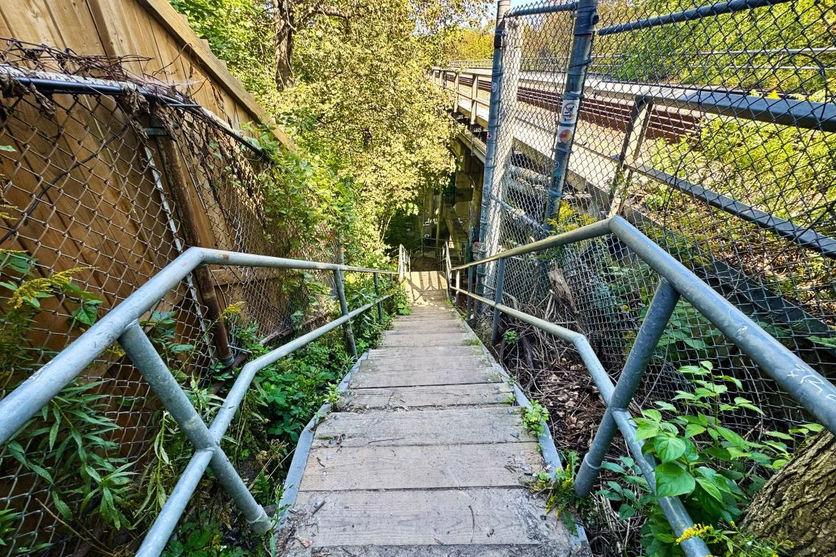
The Midtown Ravines Group recognizes no fewer than 12 established access points leading into and out of the Vale of Avoca. Two of those are currently closed, and of the others, not all are in satisfactory condition.
If there is a “main entrance”, it is perhaps the paved route –the David Balfour Park Trail– that enters the ravine from the west, off Avoca Avenue, just south of Pleasant Boulevard. This is fairly close to the Yonge-St Clair intersection and transit hub. What should perhaps be the main “ceremonial” entrance to the ravine is right beside the west end of the St Clair Ave viaduct on the north side of the street; unfortunately, this has been closed for over a decade (initial steps are underway, however, for the restoration of the St. Clair entrance).
The David Balfour Park Trail leads south through the ravine. At the far southern end are two access points. One leads you towards the east: across Mount Pleasant Road, the Park Drive Trail to the Brick Works, or into North Rosedale. The other southern access route takes you into South Rosedale, and west to the Rosedale Subway stop.
From the Avoca Avenue entrance, you can also head to the north end of the ravine: a few meters down from the gate, an up-and-down trail branches off to the left from the David Balfour Park Trail and runs northward to an unobtrusive conduit that takes you into Mount Pleasant Cemetery, where you can enjoy another oasis of tranquility in an arboretum setting, you can continue along to connect with the Beltline Trail to head either east or west, or you can travel further north into the Davisville neighbourhood.
This map identifies all twelve of the established access points, and provides a summary of the local connections. Please keep in mind that a number of these access points are in poor condition, may take you on steep slopes, and may have icy or muddy trail sections depending on the time of year. Efforts are underway looking at ways to improve the ravine’s access routes and pathways. Please exercise appropriate caution on any excursion into the Vale of Avoca.
Exploring the Vale and Ravines
- Nature Walk in the City: Toronto’s Vale of Avoca – YouTube, August 2025
- The Vale of Avoca – Paul Snyders, Substack, August 23, 2020
- The Vale of Avoca – Hiking the GTA, Sept. 5, 2015
- Vale of Avoca Reach – Lost Rivers, undated